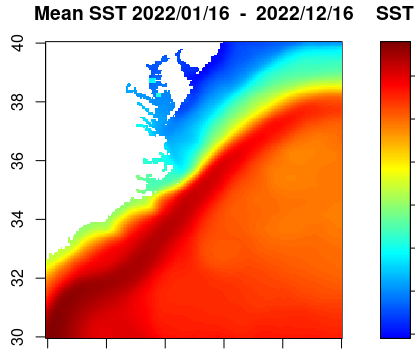
Basics of Working with Satellite Data
Learn how to access ERDDAP data, handle NetCDF files, and create SST maps and time series.
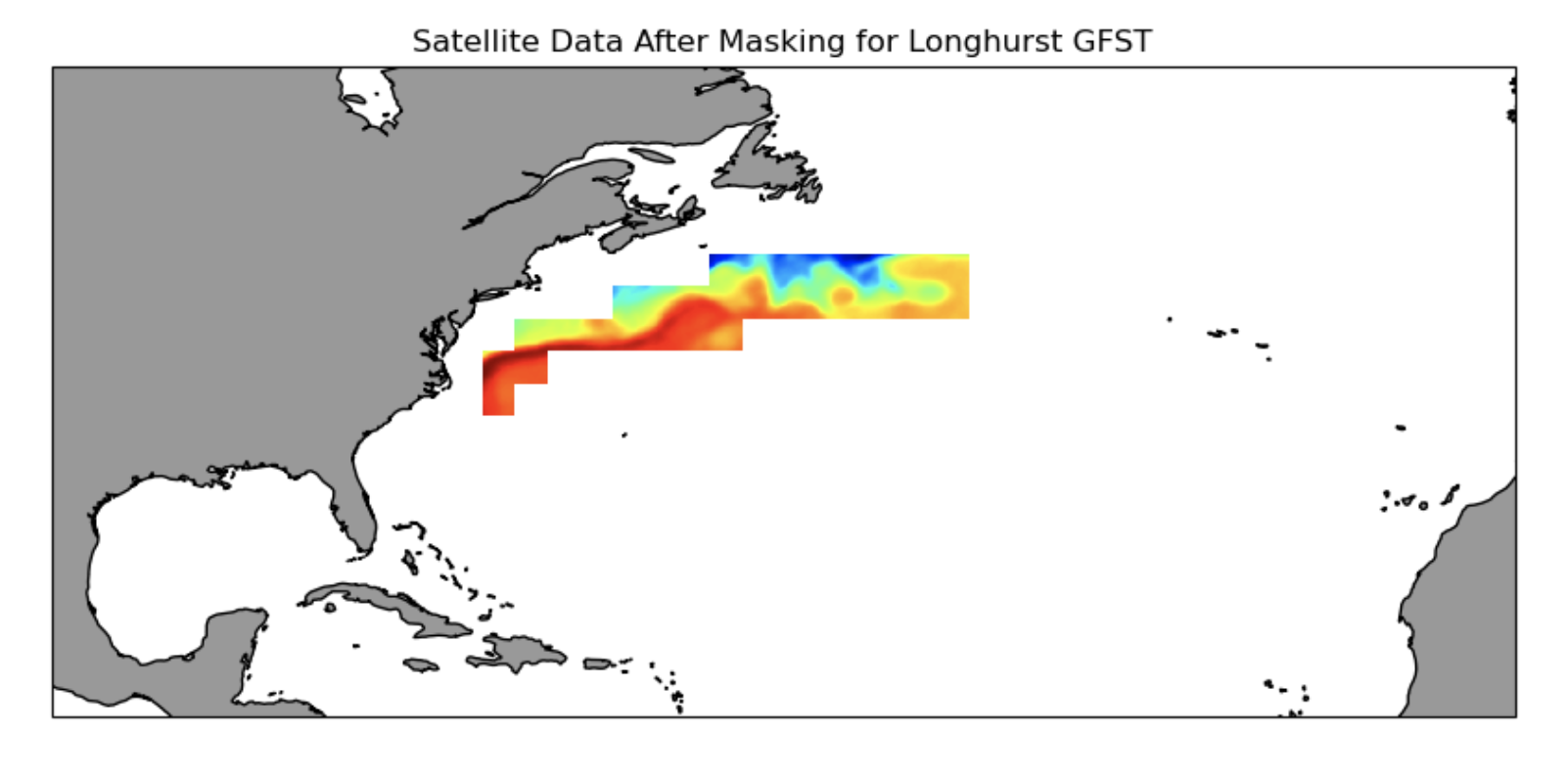
Extract Data Within a Boundary
Learn how to download SST time series data from an ERDDAP server, mask the data to retain only the data within an irregular geographical boundary (polygon), and plot the yearly seasonal cycle within the boundary.
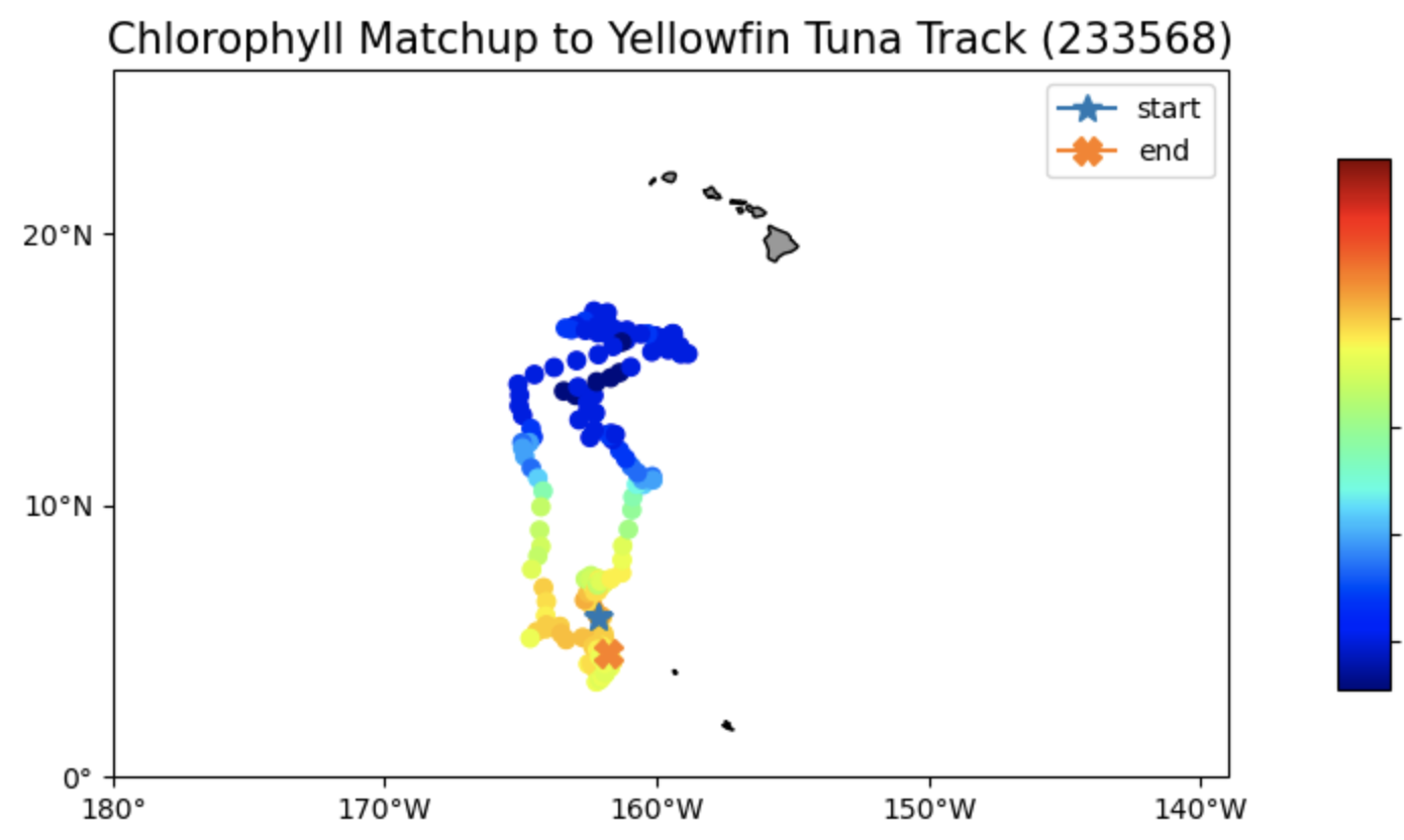
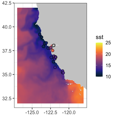
Matchup Satellite Data to Telemetry Data
Learn how to extract satellite data around a set of points defined by longitude, latitude, and time coordinates, like that produced by an animal telemetry tag, and ship track, or a glider tract.
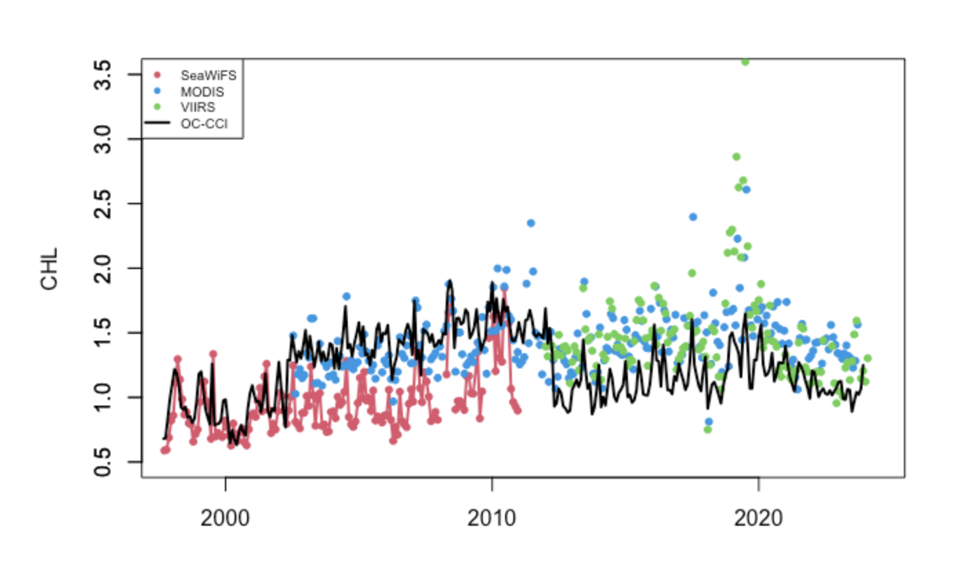
Compare Time Series from Different Sensors
Learn how to extract a time-series of monthly satellite chlorophyll data for the period of 1997-present from four different monthly satellite datasets.
Match Up Satellite and Buoy Data
Learn how to match up satellite data to in situ buoy data using rerddap and rxtracto R packages.
Define a Marine Habitat
Learn how to map satellite sea surface temperature and overlay the 17.5¡C and 18.5¡C contours associated with loggerhead turtle bycatch product, TurtleWatch.
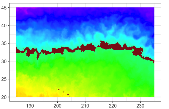
Convert -180+180 to 0-360 Longitude
Learn how to use datasets with -180 to +180 longitude values to work within regions that cross the antimeridian.
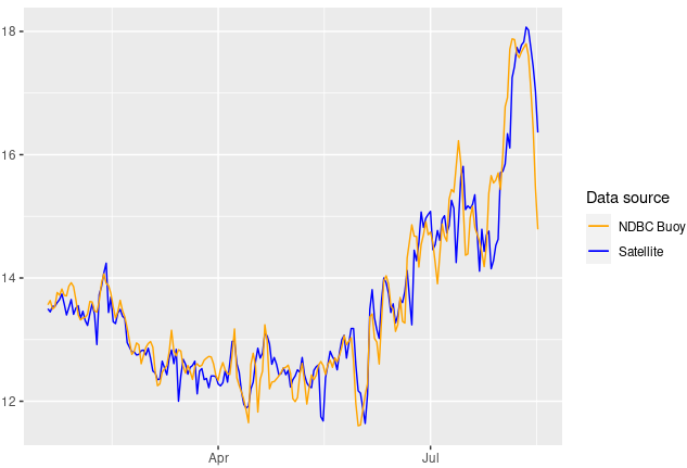
Create a Virtual Buoy with Satellite Data
Learn how to create a time series from satellite data to gap-fill or replace buoy data.